QuickGrid is a free software for making contour maps or 3D mesh using XYZ dataset. It is a good free alternative to Surfer.
Download and in the QuickGrid lets see how quick it is to generate a contour map.

First we have to prepare our dataset like this:-
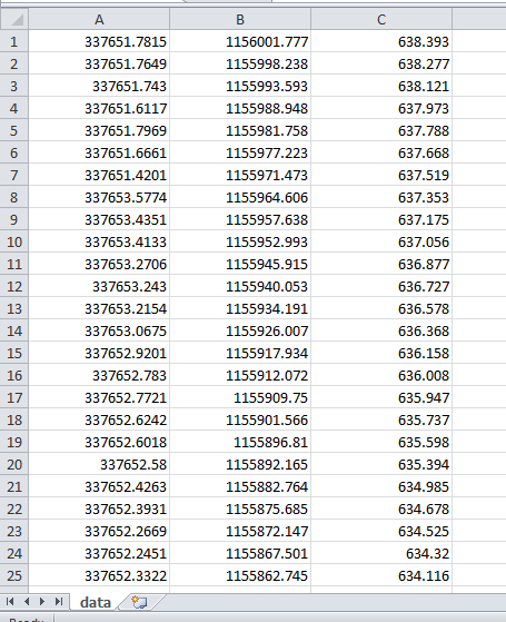
The first column is X (Easting or Longitude), second column is Y (Northing or Latitude) and the last column is Z (Height or Altitude). Note that there is not column name for the data and is saved as a .CSV file.
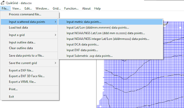
To load in the dataset, go to: File >> Input scattered data points >> Input metric data points
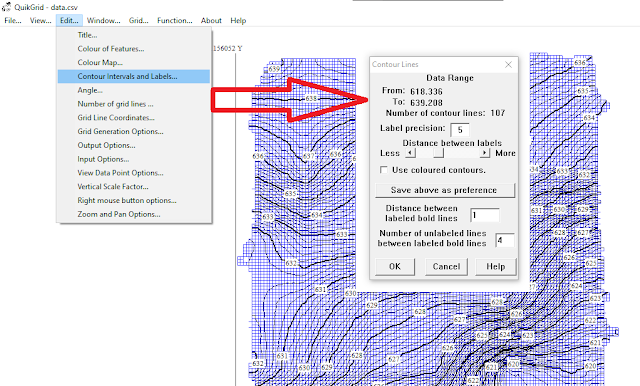
Now we can style the contour interval and labels like this:-
If you want to use the contour in AutoCAD, set the output option to use polyline for DXF output.

Then you can export to AutoCAD from the 'File' menu.
There is a lot more you can do with QuickGrid, however this is a good start for you to explore more on the software.
Thank you for following.
No comments:
Post a Comment